


Central America is located along the Ring of Fire where the subduction process causes high volcanic activity, as well as intense earthquake activity. In addition it’s an area that is located between the Pacific and Atlantic Oceans, where hurricanes affect constantly El Salvador and other neighboring countries.
In El Salvador during the rainy season or when major earthquakes affect the area, processes like mass movements (small, medium and large order), liquefaction, erosion and floods change the morphology of the territory (Rose et al., 2004; Jibson et al. 2004; González et al. 2004). The problematic have been increased in recent years, with rains connected with hurricanes or tropical depressions like Mitch (1998), Stan (2005), Ida (2009), Alex (2010), Agatha (2010) and 12-E (2011); as well as earthquakes in 1986 and 2001 mainly (Evans & Bent, 2004). For this reason, each year the local governmental and international offices have to invest large sums of money in the reconstruction of public and private infrastructure in addition to the significant environmental and social impact that the country suffer.
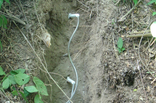
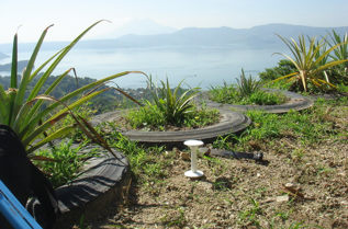
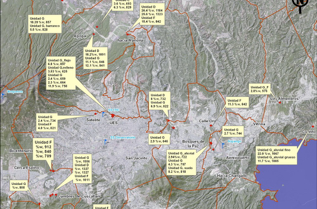
The more problematic region in the Metropolitan Area of San Salvador occurs especially in the extent deposits of the volcanic tuff called “Tierra Blanca Joven” (TBJ) which is product of the last plinian eruption of the Ilopango Caldera (A.D. 536 according to Dull et al., 2010), whose products are an intercalation of layers of fall, pyroclastic flows and surges. Previously there have been some studies about monitoring of slopes in weathered soils (Ng et al., 2008) to verify design assumptions or for use when checking validity of any analytical and numerical models.Currently, field monitoring is starting in Tierra Blanca Joven (TBJ). The use of Quickdraw tensiometers (direct measure of matric suction) and TMS of TOMST (to obtain soil moisture content) could be a good way to build a methodology for an early warning system for the slopes. In the preliminary results using TMS1 is possible to observe some tendency in the results in spite of different conditions in the monitoring places. TMS measures temperature at levels -10, 0 and +12 cm relative to soil surface when installed vertically; in the preliminary results for TBJ the average temperature difference between surface and inside the slope is 3.8°. Gravimetric water content of monitored TBJ units during the beginning of the dry season revealed elevated capability of retention of water and weathering processes that can contribute in the problematic of mass movements during the rainy season.The use of tensiometer (an established method) can help to validate the use of TMS into geotechnical monitoring. The evolution and changes, of suction and water content, experimented in different places of the MASS will help in the understanding of the relation between rain, evaporation, weathering processes and critical soil moisture content of TBJ.
Links to published papers:
http://www.jgeosci.org/content/jgeosci.088_2011_1_lexa.pdf
http://www.geologia.ucr.ac.cr/revista/revista/to_pdf/revista/46/chavez_et_al.pdf
http://www.geologia.ucr.ac.cr/revista/revista/to_pdf/revista/47/06-Chavez%20et%20al.pdf
http://article.sciencepublishinggroup.com/pdf/10.11648.j.earth.20130202.15.pdf
http://link.springer.com/article/10.1007%2Fs11069-013-0948-8